Tuesday, August 27, 2019

Exploring Despair at Manzanar National Historic Site


The U.S. National Park System (NPS) dates back to Yellowstone’s 1872 establishment as the first in what's become a chain of true American wonders.  Lucky for tourists, the number has grown by 2019 to a total of 61 breathtaking living landscapes. Each treasure offers distinctive vistas, climate, wildlife and sometimes otherworldly terrain. Heavily protected, they still provide a variety of recreation facilities for all who visit. 

Serene beauty in Yosemite National Park
The NPS also manages 419 national monuments and historic sites, ranging from historic homes to buildings, trails, markers, battlefields and cemeteries. The Good Girls give top priority to visiting these NPS sites whenever we travel, but not all produce the highs that the parks offer. Entering some takes cautious, open minds and yields sometimes uncomfortable glimpses of our country’s many-faceted history. 

The Good Girls previously witnessed gut-wrenching tales of Civil War prisoners at Andersonville in Georgia. We watched a reenactment of the Battle of Little Bighorn in Montana, an example of a long and brutal conflict with Native Americans. Living in Florida, aka the South, we have encountered numerous sites and museums depicting the struggles for Civil Rights like Brattonsville, SC.

Statue in Vicksburg Nationl Cemetery, Mississippi

Vicksburg National Cemetery
Manzanar National Historic Site in Inyo County, California, 225 miles north of Los Angeles, takes you down a very different pathway to our past. Manzanar functioned a Japanese Internment Camp from 1942-45. More than 10,000 displaced Asians were kept captive there. Of those, 87 percent were American citizens, sent away merely because of their ethnic background and the fears it produced among an American public wrenched into a war it wanted to avoid. 

The Visitor Center welcomes guests to Manzanar National Historic Site. 
I’m almost embarrassed to admit that I don’t recall learning about the Japanese confinements during my school years. I first caught this agonizing glimpse of the past while reading a novel. Much more than a glance, my trip to Manzanar engulfed me in a history lesson I will never forget. 

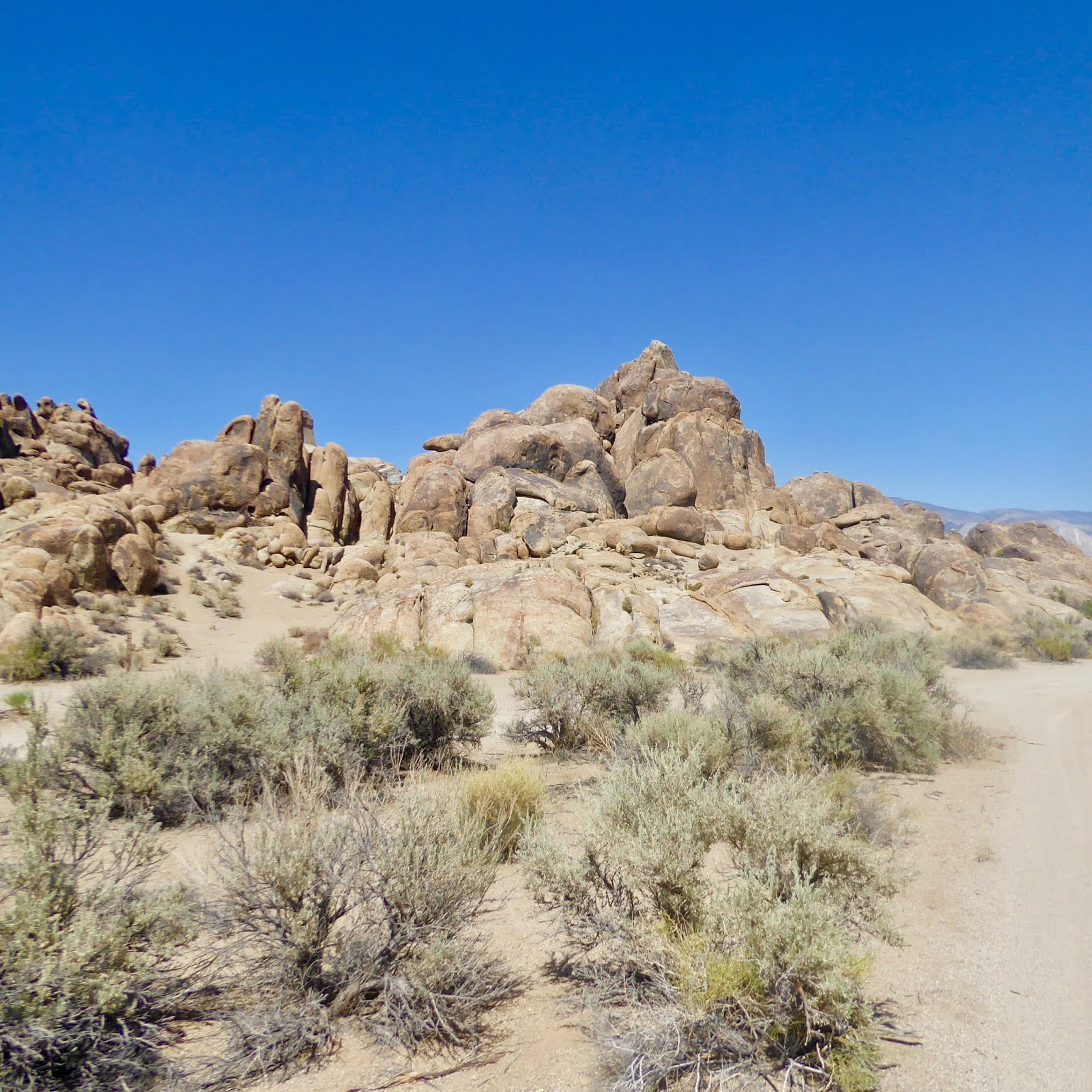
My first impression on arrival - - a flat desert in the middle of nowhere, backed by barren mountains, far from my daily view in lush, green, and humid Florida. Manzanar coats its scenery with thick dust, little tree or shrub life daring to break through cracked earth. The lack of water makes it impossible to envision the large community once there. 

Desolate grounds of the former Japanese Internment Center named Manzanar.

The Japanese attack on Pearl Harbor on December 7, 1941, made a crisis of long-standing hostilities and prejudices of my Americans toward the Japanese. A Franklin Roosevelt order on February 19, 1942, authorized the military to remove “any or all persons” of Japanese ancestry from the West Coast. They were deemed dangerous in an era where fear of potential sabotage and espionage ran rampant. Forced to leave their homes, business and belongings abruptly, many had only days to prepare. 

The government eventually deprived over 120,000 people of their freedom, sending them to 10 camps across the nation. Half children and young adults, 10,000 of the dispossessed arrived on buses and trucks at Manzanar War Relocation Center. All they had beyond what they could hand-carry was an identification number assigned to them. Two out of every three were American by birth. 

A reconstructed watchtower stands in the field. Manzanar was surrounded by eight towers. 

A 550-acre housing section (1-square mile) constructed and surrounded with barbed wire awaited. Military police manned eight guard towers, used searchlights, and patrolled the grounds. Outside the fence, some 5,500 more acres contained military police housing, a reservoir, a sewage plant and agricultural fields. The backdrop of the stark mountains completed the picture of confinement. 

The layout of buildings with Manzanar War Relocation Center.

I highly recommend your visit to the site start with a 22-minute movie in the interpretive center. Afterward, look at the exhibits and audio-visual displays; not many structures remain on the property. Then, you can choose to take a self-guided walking tour or 3.2-mile car circumnavigation of the camp, including some reconstructed buildings. National Park Rangers now patrol the grounds, exchanging answers to questions and leadership of tours for threat and confinement. 

Don't miss the film: Remembering Manzanar 
Photos and interactive displays in the Interpretation Center.

At its peak, 504 barracks organized into 36 blocks crowded the campgrounds. Each block included 14 barracks, divided into four apartments - - producing individual spaces of only 20-by-25-feet. Any combinations of eight individuals were allotted to an apartment. 

An apartment for eight
An oil stove, a single hanging light bulb, cots, blankets and straw-filled mattresses offered the only furnishings. The space reminded me of a basic scout camp, with single and double cots and lack of other furnishings, and without the promise of returning home in a few short days.

Items built my internees or later acquired at the camp.

The internees had little or no privacy; mere open spaces comprised the men’s and women’s showers and latrines (as they were called). The reconstructed bathroom on the site tour succeeded in producing the feeling of humiliation those consigned there must have felt many times each day. 

A total lack of privacy in the women's toilets.

The park ranger added to the sense of despair that must have blanketed the place, describing the wicked dust storms that invaded the hastily built barracks. The internees had to stuff socks in the floorboards and windows to keep out the dirt. A small concession, later covering the floors with linoleum helped to ease at least that problem. 

The Barracks stand above the barren earth on cinder blocks. 

Most of the internees worked in the camp. They dug irrigation canals, tended the farms and livestock, made clothes and furniture for themselves or worked within the camp as mess hall workers, doctors, nurses, teachers, etc. Professionals were paid just $19 per month. Modest though these products were, they memorialize the indomitable spirit that infuses us all. 

My group walked around the grounds trying to imagine the scene from nearly three-quarters of a century ago. The few visible reminders include concrete outlines of some buildings, former rock gardens, and an old basketball court. A ranger explained that the internees developed their own leagues, clubs, gardens, and activities to help pass the time. 

A basketball court at Manzanar War Relocation Center

They built a library, published the Manzanar Free Press and operated cooperatives. We stopped into one of the reconstructed mess halls - - I imagined lining up for communal dining three times a day. American- style meals were served, adequately nourishing, but yet another source of alienating the more elderly to whom such food was unfamiliar. 

Reconstructed Mess Hall at Manzanar


The confinement period lasted for three years, when, in January 1945, the West Coast exclusion order was lifted. Japanese Americans were given  $25 and a bus ticket to wherever but they were not allowed to own land in California. Many had nowhere to go and no jobs anymore. The last internee, a four-year-old boy, left Manzanar on November 21, 1945. By March 20, 1946, all 10 war relocations centers across the U.S. were closed, ending a dismal chapter in America’s past.  

In 1988, a U.S. Civil Liberties Act granted a $20,000 payment and apology to 82,000 former internees. 

While we can’t change history, this site forces us to remember some of its darkest acts. The United States may be called the land of liberty, but it has not always held itself consistent with the definition. Manzanar forces visitors to remember the protections promised in our Constitution and the consequences when we ignore them. 


Manzanar National Historic Site
5001 Highway 395, P.O. Box 426
Independence, CA 93526

Admission is free. 
Manzanar became a designated California historic site in 1992. The Interpretive Center opened in 2004. The official purpose of the Manzanar Historic Site is to preserve Manzanar’s cultural and natural resources and interpret the forced removal and incarceration of Japanese American and Japanese immigrants during WWII.


Photo by Ansel Adams, 1943, on a visit to Manzanar. Photo from the Library of Congress Collection


Tuesday, August 20, 2019

What next? See the best free museum, eat the biggest pancake en route to Mt. Whitney and off-road around old tungsten mines

There is so much to see and do around Bishop we had to save the Owens Valley Radio Observatory, the White Mountain Research Center and the ancient Bristle Cone Pine Forest for another trip. 


We were glad we didn't skip the Eastern California Museum in Independence, which proved to be a many-faceted gem. 

We began with the historic equipment yard, begging to be photographed, 


then moved into the Engine House to see #18 steam engine, the Slim Princess, that volunteers had impeccably restored to working order

From there we wandered through "Little Pine Village," a tree-shaded collection of early settlers' buildings from a multi-seater outhouse to post office. 


Next we explored the Mary de Decker garden of native plants.


Already impressed, we were awed by the variety of materials in the museum itself, first and foremost the collection of some 400 Paiute and Panamint Shoshone baskets, utilitarian and trade. 

The trade baskets were jewels of design, those woven for use - up to 47 to 50 stitches per square-inch - were virtually waterproof. 


We could have spent the better part of a day wandering through exhibits of the life and characters that inhabited the area. 


Where else would you find the story of mountaineer Norman Clyde, nicknamed the "pack with legs" for the 80-pound backpack he carried ascending the peaks within the Sierra Nevadas? 


Or a suit  worn by Amelia Earhart, whose husband found refuge here after her disappearance?

Don't miss this remarkable, and free, gem.


The drive up to Mount Whitney Portal  at an altitude of 8,360 feet is another don't miss. From the trailhead behind the Portal you will have to hike and climb another 6,044 feet through wilderness to reach the top of the highest mountain in the continental United States.

For most of us, the Portal with Lone Pine Creek Falls, picnic grounds, store and diner is entertaining enough. The pancakes, promoted as the world's largest, are another memorable sight and taste. 
Why the big pancakes? Story is that three kids stopped their bikes, came in and asked for the "cheapest, biggest thing to eat you have."  They caught on.
Doug Thompson
It's a precarious economy, said author, owner of Portal plus its Hostel in Lone Pine and 30-year veteran of the mountain, Doug Thompson. "There's no economy except tourism. The year starts in June and ends four months later." Skiing is out, he added. "The good news is there's lots of snow, the bad news is the roads are closed."


There were roads and sometimes we stayed on them when we went off-roading with Randy and Susan Gillespie, owners of Off Road Rentals. 

Donning our helmets and settling into a Yamaha Viking UTV, we headed into the Tungsten Hills mining area of Buttermilk Country that abuts the John Muir Wilderness.


Up, bounce, jerk, down, bang, twist, repeat. With variations in order, this was the tempo throughout our rough and rocky ride. 


From the late 1800s until the 1930s, this area was pocked with tungsten mines, from the world's largest to smaller efforts, plus a few gold digs. In 1980 mining in the area was ruled illegal. 


According to Randy, there's still tons of tungsten to be had, but demand has lessened for the second-hardest element known to man with the highest melting point - 6125 degrees F - used to harden  metals for everything from tools to armaments and projectiles to electronics. 

We stopped for a picnic lunch amid the boulders of Buttermilk Country which offered a bit of shade in the otherwise treeless area. 


We had never heard of boulder climbing but this is where you come to do it. 


We looked back at photos we had taken and were dismayed by how badly the increasing haze overlaying this usually smog-free area affected their clarity.


The devastating fires engulfing the Sierras were coming closer. Did not bode well for images in Mammoth Lakes, our next stop.


Saturday, August 10, 2019

We find home on the range with our movie star heroes in Bishop and Pioneerville

Bishop and Pioneertown, Western Backdrops

At elevations of 4,150 and 4,000 feet respectively, both Bishop and Pioneertown, CA, are considered high deserts. 

Nestled in Owens Valley, east of the Sierra Nevada mountain range along the famous El Camino Sierra, Bishop is the only incorporated town in the county. 


Known as the "Little town with the big backyard," home of the annual  Mule Days celebration, Bishop and its neighbors Lone Pine, Independence and Big Pine have much to offer visitors as we soon discovered. 

The history here is sadly typical. White settlers arrived in 1861, the first stockman, Samuel Bishop, lending his name, to the town. Cattle and other livestock ate up the food, almost starving out the native tribes. With the discovery of silver, miners cut down the pinyon pines for support beams and ore smelting, eliminating the fatty nuts that had long sustained the Indians. As today's residents say, "The Homestead act of 1862 put the nail in the Indians' coffins."

Then a canny Los Angeles investor managed to snatch the water rights to Owens River for his city and the aqueduct it built. (See the movie Chinatown.)

Alabama Hills


Discovery by Hollywood location seekers put Owens valley on the movie and later, tourist maps. 

We had the deja vus after turning off the highway at Lone Pine and driving through the Alabama Hills and soon knew why. 

See any Lone Ranger, Cisco Kid or Hopalong Cassidy TV shows while growing up? Tim Holt, Tex Ritter, Gene Autry or Roy Rogers movies? 

"Lone Pine is where the West became the West," said Don Kelsen of the Museum of Western Film History.
On the way to Mt. Whitney.
The Alabama Rocks and rugged terrain up toward Mt. Whitney also stood in for India, China, Afghanistan and other planets in films such as Lives of the Bengal Lancers, Charge of the Light Brigade, Gunga Din, High Sierra, Bad Day at Black Rock, How the West Was Won, The Long Trailer, Star Wars, Iron Man, Transformers. Not to mention just about every Jeep and all other makes of car TV commercials ever aired aired. 

After returning to our childhoods and magic Saturdays in darkened movie theaters 
You'd never know Roy Rogers was Judy's fave.


and well-lit living rooms 


As a kid, did you dress up to match your cowboy hero?
as we toured the museum, watched a film and drooled over everything from classic cars
1937 Plymouth coupe and Bogey, the star who drove it in High Sierra.

to movie stars' hats, costumes and six shooters, 

William Boyd's hat when he became Hopalong Cassidy.


Vests worn by Roy Rogers and Dale Evans.


Wielded by Gregory Peck.


we accompanied Don back to a specific are a of Alabama Rocks. 


Shot script from The Lone Ranger episode "Counterfeit Mask" in hand, Don shows us where the horsemen arrive., surprising Tonto and the Lone Ranger.
There we followed the the script to sites where scenes of the 1956  Lone Ranger episode were shot. 
Scout and Silver's ears are back because they did not get along.


Hi-ho, Hollywood! 

Dining in Bishop is casual and fun. We found good barbecue at Holy Smoke and whopping burgers and steaks in the lively setting at Aaron Schat's Roadhouse.

 Pioneertown  may be the only town named after a Western quartet. Story goes that movie bad guy Dick Curtis halted his horse on a grassy knoll and said, "This is the place." In 1946, he, and investors like members of the Sons of the Pioneers (who sang with the singing cowboys and were so popular the town was given their name), Roy Rogers, Philip N. Krasne, Gene Autry and Russell Hayden built Pioneertown as a working movie set. 


 Selected for its versatile terrain, the area could replicate the scenery of  seven Western states. At its peak, the Pioneertown complex included The Townhouse, a 20-room motel for cast and crew; corrals, stables, a sound stage and storage facilities; the Golden Stallion, a Chinese restaurant; two saloons and a six-lane bowling alley that kept Roy Rogers entertained. More than 50 films and a number of television series were shot here.

Today the Townhouse is the Pioneertown Motel, open to all, some of its rooms named for cowboy stars.

Gene Autry was known for holding late night poker games in his. 

No TVs but free Wi-Fi and folding chairs you are welcome to use on jaunts during your stay. 

And yes, there is a lively saloon and restaurant, Pappy and Harriet's a short walk away. 

For breakfast, the Good Girls hopped in a car and headed to nearby Frontier Cafe. Worth the wait.


Like Bishop, Pioneertown is one of several communities including 29 Palms, Yucca Valley and Joshua Tree beyond Palm Springs. More about those later.